
Category:Maps of the Bight of Benin
bay  .jpg)  | |||||
| Upload media | |||||
| Instance of | |||||
|---|---|---|---|---|---|
| Part of | |||||
| Named after | |||||
| Location | Benin | ||||
| Inception |
| ||||
| Elevation above sea level |
| ||||
| Origin of the watercourse | |||||
| Inflows | |||||
| Basin country | |||||
 | |||||
Media in category "Maps of the Bight of Benin"
The following 16 files are in this category, out of 16 total.
-
 A chart of the Bight of Binnin - btv1b531687948.jpg 6,937 × 5,541; 6.71 MB
-
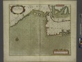 A chart of the BIGHT of BINNIN from Ningo Grande to R. Andoney NYPL1640666.tiff 5,520 × 4,580; 72.33 MB
-
-
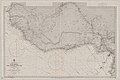 Admiralty Chart No 594 Africa west coast River Gambia to Cape Lopez and Anno Bom, Published 1885.jpg 12,439 × 8,287; 14.14 MB
-
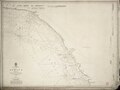
 Admiralty Chart No 595 Cape Three Points to Cape Formoso, Published 1928.jpg 16,248 × 11,062; 54.32 MB
-
 Golf van Guinee.jpg 891 × 557; 78 KB
-
 Golf von Guinea.jpg 891 × 557; 53 KB
-
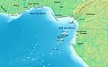
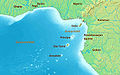
.jpg/120px-Gulf_of_Guinea_(blank).jpg) Gulf of Guinea (blank).jpg 891 × 557; 136 KB
Gulf of Guinea (blank).jpg 891 × 557; 136 KB
-
_(cropped).jpg/120px-Gulf_of_Guinea_(English)_(cropped).jpg) Gulf of Guinea (English) (cropped).jpg 563 × 392; 133 KB
Gulf of Guinea (English) (cropped).jpg 563 × 392; 133 KB
-
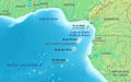
.jpg/120px-Gulf_of_Guinea_(English).jpg) Gulf of Guinea (English).jpg 891 × 557; 155 KB
Gulf of Guinea (English).jpg 891 × 557; 155 KB
-
.jpg/120px-Gulf_of_Guinea_(pl).jpg) Gulf of Guinea (pl).jpg 891 × 557; 160 KB
Gulf of Guinea (pl).jpg 891 × 557; 160 KB
-
 Gulf of Guinea es.png 835 × 522; 180 KB
-
 Gulf of Guinea fi.jpg 800 × 500; 93 KB
-
 Gulf of Guinea ru.jpg 891 × 557; 164 KB
-
 Gulf of Guinea-fr.jpg 891 × 557; 164 KB
-
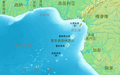 Jineiya wan-zh-tw.png 891 × 557; 516 KB


_(cropped).jpg)
.jpg)


.jpg)